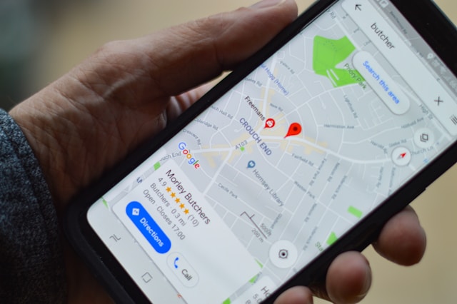
Have you ever followed maps to go to a restaurant only to end up at a hair salon? While it’s a rare occurrence for users, it’s a serious concern for mapping apps. In this particular case, the problem can be outdated data used by the Geocoding API or a human error.
If you don’t want your app users to face such problems, you should use a well-reputed geocoding API. But what’s more important is knowing how to use geocoding API in your app.
Today’s article is all about that. You’ll learn how to get geocoding API key and then integrate the API into your apps. We’ll also introduce you to a reliable geolocation API with useful features.
Let’s begin by understanding what an API for geocoding is, shall we?
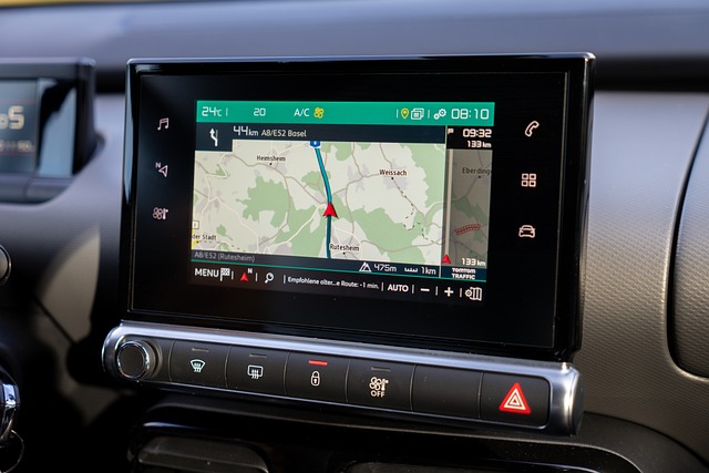
Table of Contents
What Is a Geocoding API?
Geocoding is a process that converts physical street addresses into geographical coordinates and back. A Geocoding API serves as an interface between applications and geocoding services typically provided by map services like Google Maps.
These APIs deliver detailed data such as the country code and exact latitudes and longitudes.
This makes geocoding APIs crucial in mobile and web apps, as they convert user-provided addresses into precise geographic coordinates. Geocoding helps in mapping user locations, plotting routes, and pinpointing specific places on a map.
App developers can use geocoding API to enhance features like real-time tracking, nearby place searches, and location-based notifications.
Integrating geocoding APIs helps developers automate the location data retrieval process, which ensures accuracy and saves time.

How To Use Geocoding API
Using a Geocoding API in mobile and web apps involves several steps. First, developers must obtain an API key from the API provider. The API key allows access to the Geocoding API services.
To integrate the API, developers send API requests containing addresses or place names. The API processes the request and returns coordinates in the API response. This response includes latitude, longitude, and more information, which developers can use for mapping or location services.
For reverse geocoding, the process is similar but reversed. Developers send coordinates in the API request, and the API returns the nearest address.
Integration differs based on requirements. For real-time applications, developers use single requests for immediate data. Developers typically use temporary geocoding for applications that don’t require storing the geocoding results.
For batch processing, developers send multiple addresses in a single request to optimize performance. Applications that use batch geocoding typically require permanent geocoding services to store the results and use them for providing solutions.
Developers must handle API responses carefully to ensure accurate and efficient data usage. Proper error handling and rate limiting are essential to maintain app performance and avoid service disruptions.

How To Get Geocoding API Key
A Geocoding API key is a unique identifier that allows developers to access geocoding services. It ensures secure, controlled usage and tracks API requests.
Here’s how to get a geocoding API key:
- Create an account with the API provider (e.g., Google Maps, Mapbox).
- Go to the API or Developer section of the provider’s website.
- Set up a new project or select an existing one.
- Activate the Geocoding API for the selected project.
- Click on the option to generate an API key.
- Set any necessary permissions or restrictions for the API key.
- Copy the generated API key to use in your application.
The key typically looks like a long string of letters and numbers. Developers embed this key in their API requests to authenticate and access mapping services such as Mapbox geocoding.
For example, when making an API request to convert an address to coordinates, include the API key in the request URL. The API response will contain the geographical data. This key only processes authorized requests, which helps maintain security and service quality.
6 Basic Steps for Integrating Geocoding APIs
Integrating an API for geocoding features into mobile and web apps is a complex task. However, here’s a basic step-by-step guide with code snippets on how to do this.
Step 1: Set Up Your Environment
Ensure your development environment is ready to\ make HTTP requests. For web apps, you can use JavaScript. For mobile apps, you might use Swift for iOS or Kotlin for Android.
Step 2: Install Necessary Libraries
For web apps, you can use libraries like Axios or Fetch API. For mobile apps, you might use platform-specific libraries. Here’s an example in JavaScript using Axios:

Step 3: Set Up the API Request
Now, construct API requests to send location data to the Geocoding API and receive geographical coordinates.
You can do this by creating a function to make an API request. This function sends a single request to the Geocoding API, including the API key and address.
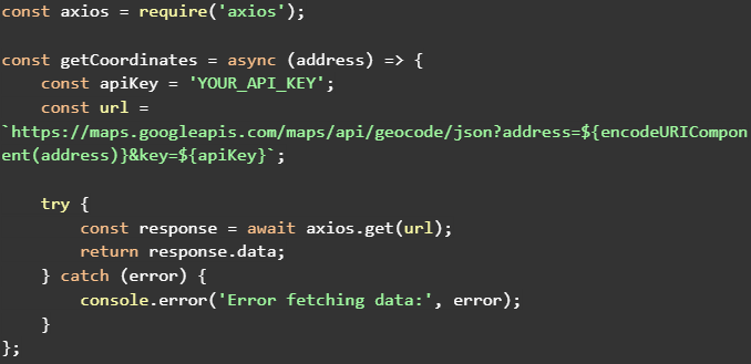
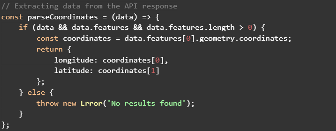
Step 4: Parse the API Response
In this step, you should process the API responses to extract and use the geographical coordinates.
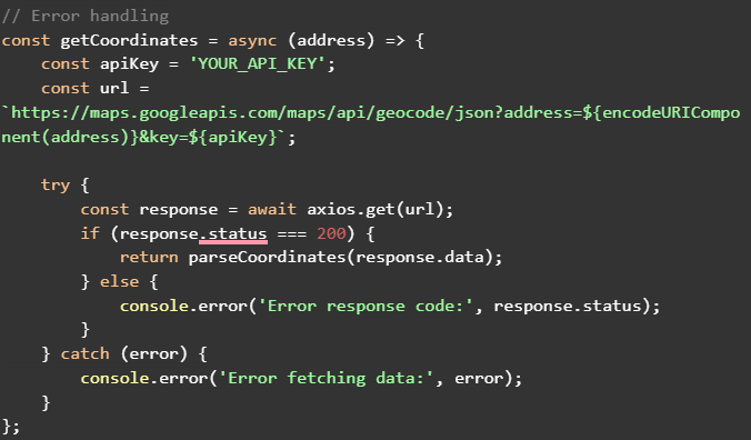
Step 5: Implement Error Handling
You must include error handling to manage issues such as invalid API keys, exceeded quotas, or incorrect addresses.
You should handle different response codes here to ensure your app behaves correctly. Common response codes include 200 (OK) and 400 (Bad Request).
Step 6: Implement the Function in Your App
Lastly, integrate the function into your app’s logic. You can use the results to display locations on maps, calculate distances, or for other location-based features in your app.
Use geoPlugin’s Keyless Geocoding API!
Geocoding is just one technology in the vast suite of geolocation services. It has far and wide industry usage, especially in daily use apps on your phone.
If your app also needs integration with a geocoding API, geoPlugin’s API is the best fit for it. geoPlugin is extremely affordable and easy to use.
Firstly, geoPlugin’s geolocation API doesn’t require an API key to access. Secondly, the API offers 120 free lookups every minute. So, if your average app traffic is below 120 requests/minute, you can use our API without paying a penny.
But even if you have higher traffic, the premium plans are affordable.
Lastly, the APIs are available in JavaScript, PHP, JSON, XML, ASP, and CSV to offer developers flexibility.
So, sign up for geoPlugin and don’t miss the golden opportunity to use our free API.

