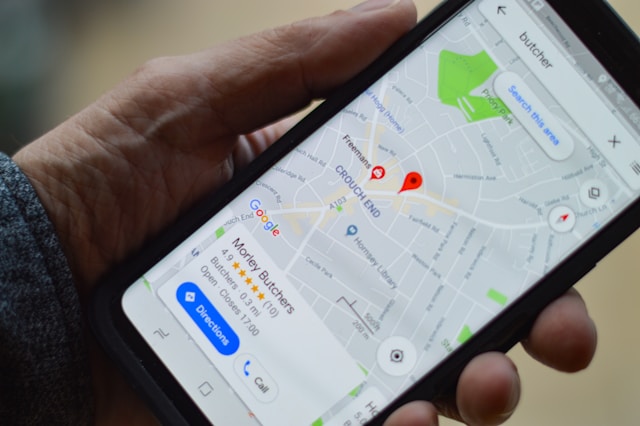
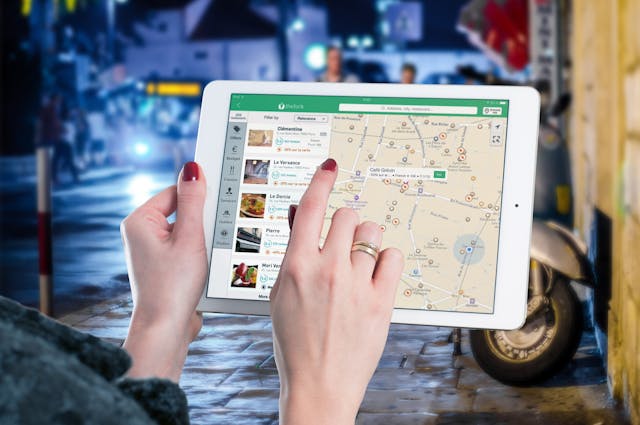
What is geolocation? Have you ever used Google Maps to find the nearest coffee shop or navigate through traffic? That’s geolocation in action. It powers real-time, location-based services that we rely on every day.
Geolocation technology uses data from various sources to determine a device’s precise location. As a result, it improves everything from navigation to personalized advertising.
But there’s more than meets the eye!
In this article, we will break down what geolocation is, how it works, and which industries benefit from it.
So, let’s start, shall we?

Table of Contents
What Is Geolocation?
Geolocation is the method of pinpointing the geographic or physical location of an electronic device, such as a smartphone.
In other words, it helps identify the global position of devices to improve services like navigation, marketing, and emergency responses.
Let’s understand it with a simple example.
Opening an app like UberEats shows you a list of restaurants that can deliver to your location.
Yes, they use geolocation technology to do that. The same goes for weather apps, order tracking systems, etc.
They identify your device’s location using GPS, IP address, Wi-Fi, or cellular networks. They use your location to offer you the most relevant options based on where you are.
However, to successfully geolocate a device, geolocation data is necessary.
Now, “What is geolocation data?” you might wonder. This is what the next section is about.

What Is Geolocation Data?
Geolocation data is simply the information used to identify the physical location of a device.
This data can come from various sources. Each source contributes uniquely to the accuracy and utility of geolocation services.
The primary sources of geolocation data include:
- GPS coordinates
- IP address
- Wifi networks
- Cellular networks
- Bluetooth and NFC
GPS Coordinates
GPS is the most precise source of geolocation data. We get GPS coordinates from satellites that calculate a device’s exact location on Earth.
This system is highly accurate, often within a few meters, making it ideal for navigation and tracking applications.
IP Address
While it is not as precise as GPS, an IP address can give a pretty good idea of the location.
For example, It can identify the city or region where the device is operating with an internet connection.
We commonly use this method for content localization and managing digital rights.
Wi-Fi Connection Points
Wi-Fi is a valuable source of geolocation data. Devices can use nearby Wi-Fi networks’ names and signal strengths to estimate location.
This is particularly useful in urban environments where Wi-Fi networks are abundant and GPS signals may be weak.
Cellular Tower
We can estimate the location by measuring the time a signal takes to travel between a device and cell towers.
This method is useful where GPS is unavailable, though it is less accurate than GPS data.
Bluetooth and NFC
Bluetooth and NFC are short-range communication technologies that can also provide location data. They do that by interacting with other nearby devices or sensors.
This is useful for indoor navigation, connecting with in-store promotions, or automating home systems based on a user’s device’s proximity.
Each source of geolocation data has strengths and limitations.
The best approach to locating devices across different environments and use cases is to use them together.
By now, you must understand what is geo location and the data it uses. Now it’s time to dot the I’s and, cross the T’s and understand how geolocation works in detail.

How Does Geolocation Work? Geolocation Tracking Explained
Tracking a location using a single data source might result in inaccurate identification.
That’s why geolocation integrates data from multiple sources to pinpoint a device’s location accurately.
As we mentioned earlier, these data sources include GPS, IP address, Wifi, Cellular networks, Bluetooth, NFC, etc.
The process begins with collecting raw data from these sources. Then, algorithms process this raw data to determine a device’s location.
This integration involves complex systems and technologies working in tandem to produce the most precise location details possible.
Here’s a closer look at how this process works and the mechanisms behind geolocation tracking:
1. Data Collection
Devices send and receive signals that include location-specific data, referred to as raw data.
Devices then transmit this data via various communication protocols depending on the technology. Examples include GPS signals, Wi-Fi pings, and cellular data exchanges.
For instance, when you use apps like Google Maps, the app sends signals to GPS satellites and receives data back. This way, it calculates how long it took for the signals to return.
2. Data Processing
After collecting raw data, algorithms process it to filter and interpret the location signals.
These algorithms assess the quality and reliability of data to determine the most probable location.
For example, in a shopping mall, your smartphone might use Wi-Fi signals from various routers to determine your position.
Algorithms analyze the signal strength from each router to estimate how close you are to each point.
3. Data Integration
The final step is data integration.
Geolocation technology’s real power lies in its ability to integrate these varied data points into a cohesive location profile.
We can achieve this through software systems that integrate and cross-verify data from multiple sources to improve accuracy and reliability.
For instance, if you drive in a tunnel without GPS signals, your phone can switch to cellular data. It can use data from nearby towers to keep tracking your location.
These were the three steps involved in the working of geolocation technology. But geolocation tracking isn’t just about finding a location.
What if a device, like a smartphone, is in a car, and the vehicle moves continuously? How would you pinpoint a location for such a device if it keeps changing?
That’s exactly where tracking movement in real-time comes into the picture.

Real-Time Tracking in Geolocation
Here’s how real-time tracking in geolocation works:
Continuous Updates
As the device moves, it continuously updates its position by sending new data to servers. Servers then recalculate the location in real-time.
This ensures that the information remains current and accurate.
This is particularly important for applications requiring instant responses like mapping directions or locating emergency calls.
Predictive Algorithms
Predictive algorithms, as the name suggests, predict outcomes that might happen in the future based on data inputs.
Some advanced systems use them to anticipate a device’s location based on historical data and current speed and direction.
This is useful for applications like traffic management and predictive policing.
What Is Geolocation on iPhone and Other Mobile Devices?
Geolocation on mobile devices like iPhones operates similarly to other devices but is often more integrated and user-friendly.
It uses a combination of GPS, Wifi, and cellular networks to identify your device’s location.
Have you ever misplaced your iPhone or any other Apple device and used the “Find My” feature?
The feature itself uses geolocation technology to locate your iOS device.
The same principles apply to Android and other smart devices, which makes geolocation a standard utility across mobile technology.
Now, let’s explore some benefits of geolocation across multiple industries.
Geolocation Applications in Different Industries
Geolocation technology helps many industries improve operational efficiency and customer experience.
Some of the industries that heavily benefit from geolocation data are:
- Retail: Retailers use geolocation to send targeted promotions to customers based on their proximity to stores. This improves shopping experiences and increases sales.
- Transportation and logistics: Geolocation is important for the real-time tracking of vehicles and cargo in logistics. It helps optimize routes and reduce delivery times.
- Healthcare: Hospitals and emergency services use geolocation for faster response times, locating patients in need, managing medical supplies, transport, etc.
- Tourism and hospitality: The tourism industry uses geolocation to provide personalized travel recommendations, navigation assistance to tourists, etc.
Take Geolocation Capabilities to the Next Level With GeoPlugin!
Understanding what is geolocation is crucial, especially if your business relies on customer location to thrive.
GeoPlugin makes accessing locations simple and precise. Grow your business by integrating GeoPlugin’s dependable, real-time geo-data services.
Sign up with GeoPlugin today and access our easy-to-use API for enhanced efficiency and accuracy!
