Hearing the term geolocation data may bring up scenarios of malicious tracking or surveillance. But that’s just a misconception.
In reality, geolocation is a technique that companies use for marketing, targeted advertising, and providing helpful solutions to users.
If you want to run a customer-centric business and increase sales, you cannot overlook using geolocation data.
But before you can do that, fully understanding what is geolocation data is important.
In this article, we’ll explore what is geolocation data, how companies collect it, and its wide-ranging applications across industries.
So, without further ado, let’s begin!

Table of Contents
What Is Geolocation Data?
Geolocation data is the location information of devices like smartphones, smartwatches, and laptops spread across the globe.
This data includes coordinates that pinpoint where a device is at any given moment.
Geolocation data typically appears as numerical coordinates, including a location’s latitude and longitude.
For example, a Los Angeles City location might appear as 34.0549° N (latitude) and 118.2426° W (longitude). This precise data helps map the exact position of a device on the Earth’s surface.
Various devices carry and transmit geo location data. Mobile devices, such as smartphones and tablets, are the primary carriers.
These devices constantly interact with GPS satellites, cell towers, and Wi-Fi networks to update their location.
Other devices, such as fitness trackers, smartwatches, and even some laptops, use geolocation data to offer location-based services.
While geolocation can provide valuable insights, it often begs the question: is geolocation data personal information?
Let’s address this question in detail.

Is Geolocation Data Personal Information?
Technically speaking, geolocation data is simply coordinates without personal identifiers.
Whether this data qualifies as personal information depends on its use and context.
It reveals the physical location of a device and, by extension, the person using it.
However, it’s important to note that geo location data is not enough to determine who owns a device.
While it shows where a device is, additional information is necessary to connect it to an individual.
For instance, when this data tracks a person’s daily commute, it can reveal personal patterns and habits.
From a legal standpoint, the classification of geo location data as personal information varies by region.
Some regulations, like the GDPR in Europe, consider it personal data if it links to an individual.
In general, the classification of geolocation data as personal information comes down to factors such as:
- Precision of data: Exact GPS coordinates are more likely to be personal information. Less precise data, like city-level location, is less likely.
- Combination with other data: When combined with other information, like device IDs, geolocation data is more likely to be personal.
Now, let’s shed some light on how accurate is geolocation data.

How Accurate Is Geolocation Data?
Geo location data varies in accuracy based on the technology and methods used.
Data accuracy is generally high at the country level and often accurately determines the device’s country.
City-level accuracy can range from hundreds of meters to a few kilometers.
These inaccuracies can occur due to several factors, such as:
- Signal interference
- Device limitations
- Environmental conditions
For instance, obstacles like buildings and trees can interfere and reduce the accuracy of GPS signals.
Sometimes, using cell towers to determine geographical location often results in less precise data. The accuracy depends on the number of nearby towers and the network’s density.
Wi-Fi-based geolocation can be quite accurate in urban areas with many networks. However, accuracy tends to decrease in rural areas with fewer networks.
For these reasons, combining multiple data sources is key to enhancing the accuracy of geolocation data.
Here are a few ways to do that:
- Hybrid positioning systems: These systems use a combination of GPS, cell towers, and Wi-Fi networks to triangulate a more precise location. By using multiple data points, they correct inaccuracies from any single source.
- Signal processing algorithms: Advanced algorithms analyze signal strength and quality to refine location data. They filter out noise and account for environmental factors.
- Real-time data updates: Continuously updating the location data helps adjust and correct the geographical location. Over time, this approach ensures more accurate positioning.
So far, we have discussed different aspects of geo location data. But what are the ways to collect this data? Let’s find out.
How Is Geolocation Data Collected?
Geolocation data collection involves various methods. Each method uses different technologies to determine the geographical location of a device.
Here are the primary methods for collecting geo location data.
1. Global Positioning System (GPS)
GPS is a satellite-based navigation system that provides precise location data.
Mobile devices with GPS receivers communicate with multiple satellites orbiting the Earth.
GPS then pinpoints location by measuring the travel time of signals from satellites to the device.
This method is highly accurate, especially in open areas.
However, accuracy can decrease in urban environments with tall buildings or dense foliage, as these can obstruct the satellite signals.
Despite this, GPS is a reliable method for most outdoor applications due to its widespread availability and high precision.
2. Cell Tower Triangulation
Cell tower triangulation uses signals from cell towers to determine a device’s location.
When a mobile device connects to a network, it communicates with the nearest cell towers.
By measuring the signal strength and timing from multiple towers, the system can estimate the device’s geographical location.
This method is less precise than GPS, especially in rural areas with fewer towers. However, it works well in urban environments where many towers are available.
Cell tower triangulation is helpful for emergency services and other applications where approximate location data is sufficient.
3. Wi-Fi Positioning
Wi-Fi positioning uses known Wi-Fi networks to identify a device’s location.
When a device connects to a Wi-Fi network, the system can locate it based on geographical data.
This method is mostly effective in urban areas with many Wi-Fi hotspots.
The process involves a database of Wi-Fi network locations and the signal strengths detected by the device.
While not as accurate as GPS, Wi-Fi positioning can provide reliable location data indoors or in areas with weak GPS signals.
It is efficient for applications like indoor navigation and asset tracking.
4. IP Geolocation
As the name suggests, IP geolocation determines a device’s location based on its IP address.
Each device connected to the Internet has a unique IP address we can map to a geographical location.
This method uses an IP geolocation database that links IP addresses to specific regions, cities, or street-level locations.
IP geolocation is less precise than GPS or Wi-Fi positioning.
However, It is still highly valuable for applications like content localization, fraud prevention, and risk management.
It provides a general idea of a user’s location without the need for direct interaction with the device. That’s why businesses use it for geofencing and geotargeting all the time.
We mentioned IP geolocation databases above. Here’s some more information about them.

What Is an IP Geolocation Database?
An IP geolocation database is a collection of IP data that links IP addresses to specific geographical locations.
It contains data such as country, region, city, ZIP code, and sometimes latitude and longitude associated with an IP address.
Companies get this data from regional internet registries, internet service providers (ISPs), and network information services.
Businesses use IP geolocation databases for targeted advertising, fraud prevention, and content localization.
By mapping IP addresses to physical locations, these databases help provide relevant content and services based on users’ geographical location.
Fine geolocation is a powerful technology, but what is geolocation data good for, and what are its use cases? Read ahead for the answer.
6 Different Applications of Geolocation Data
Geolocation data has a wide range of applications across various industries.
Here are the six main use cases, from small-scale to large-scale applications.
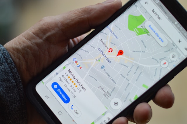
1. Navigation and Mapping
Geolocation data is a powerful tool for navigation and mapping applications.
Top GPS-based apps like Google Maps provide real-time directions that help users find the best routes and avoid traffic.
These apps use geolocation data to offer turn-by-turn navigation, traffic updates, and location-based services.
Businesses like logistics companies rely on these applications to optimize delivery routes and improve efficiency.
Similarly, ride-sharing services like Uber and Lyft use geolocation data to match drivers with passengers and provide accurate ETAs.
Even we use geolocation data while commuting daily, don’t we?
2. Location-Based Marketing
Location-based marketing uses geolocation data to deliver targeted advertisements to users based on their physical location.
Retailers and restaurants often use this strategy to attract nearby customers with special offers and promotions.
For example, a coffee shop might send a discount coupon to potential customers within a certain radius.
This approach increases foot traffic and boosts sales by reaching the right audience at the right time.
Geolocation data also helps businesses understand customer behavior and preferences.
Using this insight, businesses can create more personalized marketing campaigns.
3. Emergency Services
When someone calls emergency services from a mobile device, geolocation data helps dispatchers pinpoint the caller’s exact location.
This information helps in guiding first responders to the scene quickly.
Additionally, natural disaster management uses geolocation data to track the spread of events like wildfires and floods.
Emergency services, law enforcement, and disaster response agencies all benefit from the potential of geolocation data to improve public safety.
4. Asset Tracking
Asset tracking involves using geo location data to monitor the location and status of valuable items.
Companies use GPS trackers to track assets like machinery, vehicles, and shipping containers.
This reduces the risk of damage, theft, or loss.
For example, construction companies can track equipment to prevent unauthorized use and optimize asset allocation.
Similarly, shipping companies can monitor cargo movements to ensure timely deliveries and reduce the risk of loss.
5. Geofencing
Geofencing uses geolocation data to create virtual boundaries around a specific area. A device entering or leaving this area triggers a predefined action, such as sending a notification or alert.
Retailers use geofencing to engage customers with personalized offers when they enter a store or shopping mall.
Similarly, companies use geofencing for employee management, tracking when employees enter or leave job sites.
Geofencing is also beneficial in security systems to detect unauthorized access to restricted areas.
6. Fraud Prevention and Risk Management
Financial institutions use geo location data to verify transactions and detect suspicious activity.
For instance, if a credit card transaction happens far from the cardholder’s usual area, the system flags it for review.
Online businesses use it to prevent fraudulent activities by verifying the geographical location of transactions.
Insurance companies also use this data to assess risk factors and set premiums based on the location of insured assets.
Collect Precise Geolocation Data With GeoPlugin!
Geolocation data will be crucial for your business if you want to reach out to your customers based on their location.
GeoPlugin allows you to easily collect and use this data. Our service provides accurate information about your visitors’ geographical locations.
By integrating GeoPlugin API, you can personalize content, display prices in local currencies, or geoblock users of a certain region. This improves engagement and customer satisfaction and boosts your monthly profits.
So don’t sleep on the power of geolocation data and turn customers away.
Sign up for GeoPlugin today and start creating a more personalized user experience.